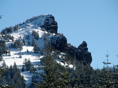
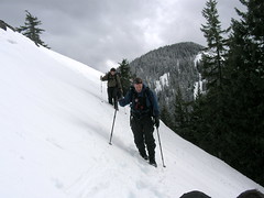
Today Jason, Justin Broderson, Chris Davis and I headed to Santiam Pass near Iron Mountain to do some winter navigation practice with both GPS waypoints and compass & map bearings. We ended up hiking all around Iron Mountain and climbing some very steep terrain. The snow was extremely deep but due to rain lately and cold nights the ground had become very hard... hard
 enough to walk on without any snowshoes. In fact, it was so hard that
  when I took my snowshoes off to kick in steps up a hill with my plastic mountaineering boots it was very hard to do so. Justin Broderson led the way with a couple waypoints that we found using compass bearings and I led the way on a contour around the backside of Iron Mountain to the north to our second to last GPS point. We ended up crossing some amazing slopes that would be perfect for backcountry skiing once I get my AT setup this spring.
  The footing on the icy ground was terrible for the most part except for a few areas that had softened up under the perfectly blue sky and
 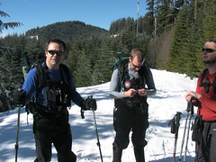 hot sun of the day. On the way down the steep front of Iron Mountain we took several spills and got some funny video and photos of us all falling and sliding on our butts down the steep terrain! We all returned to the car by 3pm so I could be rushed home to make my 5:30 bartending shift at Ruby Tuesdays. Click the title for a slide show as always.
No comments:
Post a Comment